
- The ‘Must See’ – Cryptoporticus and Theatre
- History and Roman Legacy
- Roman Itinerary
- Fun Fact – The pass at Mount Jovis
- Useful Informations for Aosta
- Our Tabernae- Where to Eat
The ‘Must See’ – Cryptoporticus and Theatre

THIS AOSTA SECTION IS PUBLISHED IN COOPERATION WITH THE FRANCESCO CORNI FOUNDATION
Aosta, in the Italian north-western region of Valle D’Aosta, near the border with France, is considered the “little Rome of the Alps” thanks to the extraordinary wealth of its archaeological sites from Roman times.
Conquered by Rome under Emperor Augustus, the city was renamed Augusta Praetoria and became strategic for its position along the Roman Via delle Gallie.
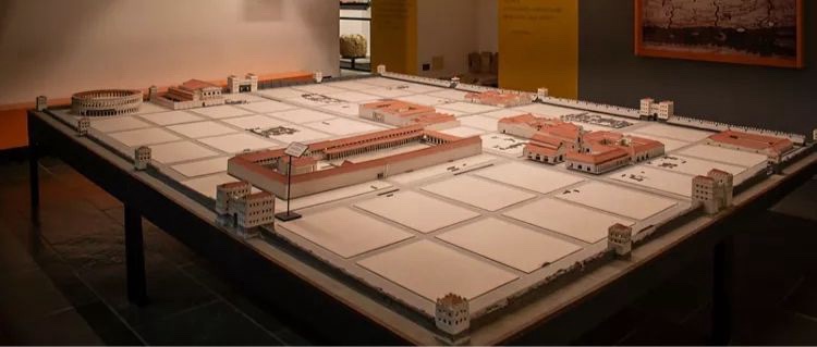
The forum of Augusta Prætoria was a vast public area with over 3 hectares of surface, from the northern walls to the Decumanus Maximus.
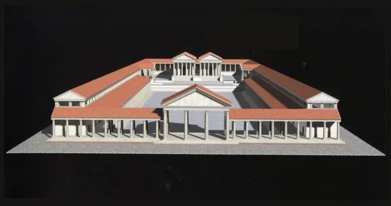
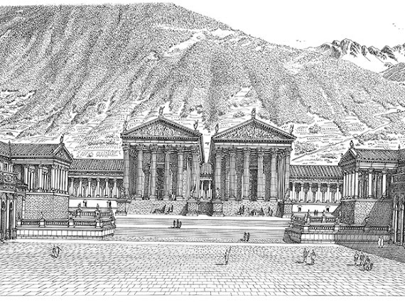
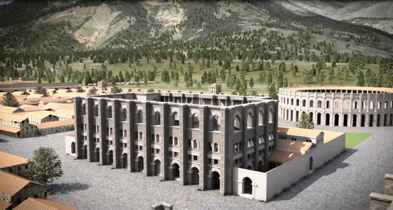
The Forum develops on an area with a natural slope and to solve the problem of the difference in height, a terrace created an upper and a lower space. The raised one defined the sacred area where two temples dedicated to the worship of Jupiter, Juno and Minerva were surrounded by a Cryptoporticus; the lower one gave access to the area of the public functions with shops, tabernae and administrative offices.
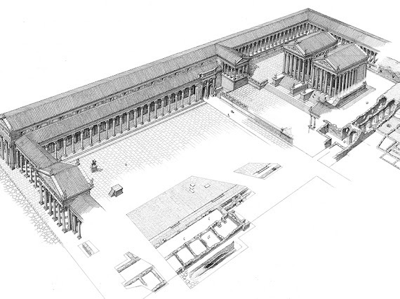
Reconstruction of the Forum with the two temples dedicated to Augustus and Rome surrounded by the cryptoporticus, on the by Francesco Corni (Reproduced with the kind permission of Fondazione Francesco Cornih ©)
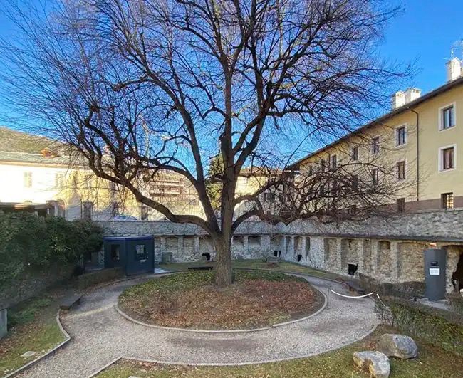
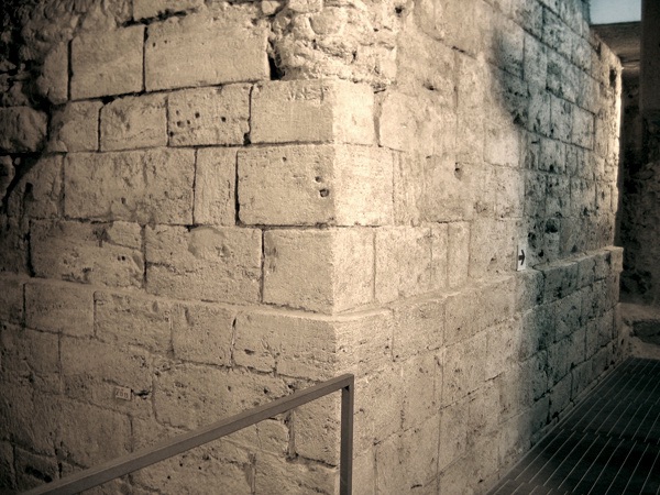
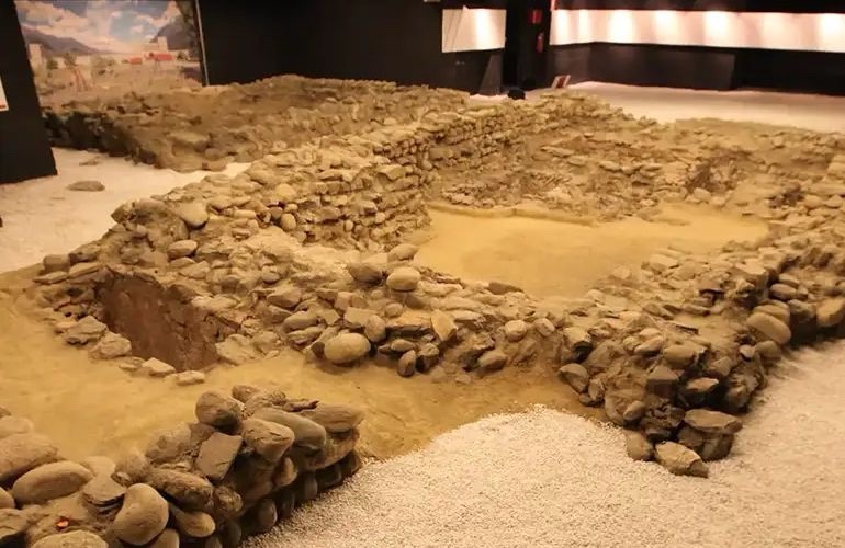
Right next to the Cathedral of Aosta, in Piazza Papa Giovanni XXIII, there is a small and charming garden: it is here, in the shade of the large lime tree planted at the beginning of the 20th century, that you can access one of the most fascinating Roman monuments of the city: the forensic cryptoporticus.
The cryptoporticus embraced the terrace of the temple on three sides and it supported another very scenographic portico. It is divided into three double corridors with barrel vaults, supported by sturdy travertine arches, and lit by splayed windows that also ensure air flow.
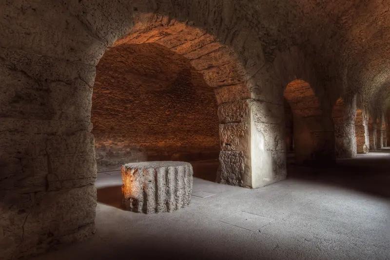
The word Cryptoporticus from the fusion of the Greek criptòs and the Latin porticus: a hidden portico, a treasure of the Augustan age not recognizable from the outside, but incredibly grandiose once inside. We are in correspondence with the sacred area of the forum of Augusta Prætoria, originally characterized by two twin temples built in a slightly elevated position to dominate the entire public area that developed sloping down towards the south.

The cryptoporticus of Aosta is divided into three arms arranged in a horseshoe and internally divided into two barrel-vaulted naves with a central sequence of lowered arches. The two lateral arms measure 71.80 m; the central one reaches an internal length of 87.10 m.
A visit to the cryptoporticus allows you to descend into the heart of the Roman city with an extraordinary atmosphere.

It was initially considered a warehouse, perhaps for the name of Marché des Romains (Romans Market) that it had kept for centuries before its identification. Its function was that of a structural element to support and contain the sacred terrace.

The tunnel system could be used as a covered walking area, a structure typical of many Northern Italy cities in the Middle Ages (Turin and Bologna have the longest ones). It was also used for solemn processions around the city’s major temples.
In the 3rd century AD the cryptoporticus actually became a depot and in the 4th century AD its eastern gallery was chosen to house the baptismal font next to the early Christian church on which the Cathedral of Santa Maria Assunta would later be built.
In the Middle Ages the Forum became a residential area and the underground tunnels were used as cellars.

It was thanks to the intuition of Ernesto Schiaparelli that, at the beginning of the 20th century, the city rediscovered its admirable cryptoporticus.
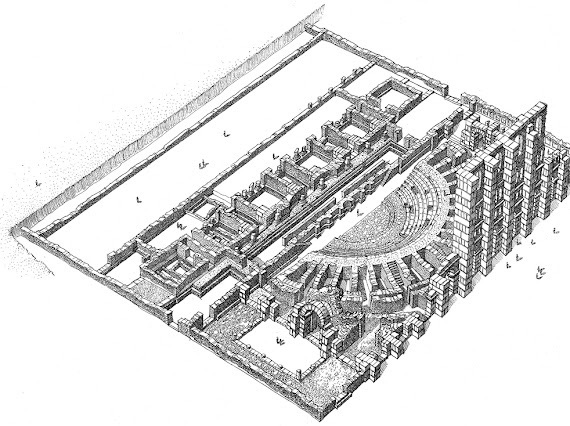
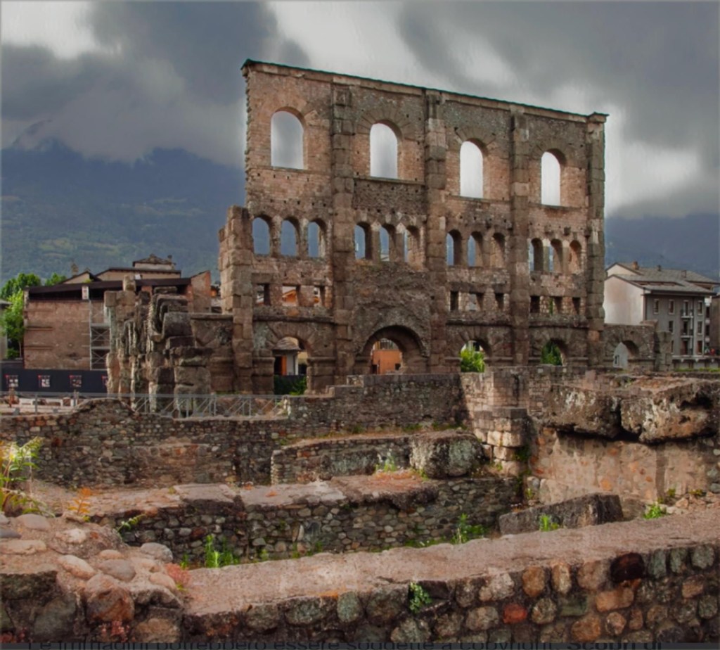
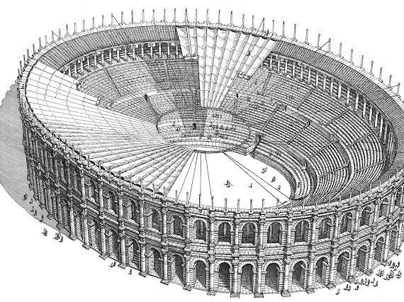
THE ROMAN THEATRE – It is the other jewel from Augusta Praetoria: a few steps from Porta Pretoria stands the majestic façade of the Roman Theatre, a masterpiece of Roman provincial architecture, measuring 22 metres in height and alleviated by three rows of arches and windows of different sizes.

The facade, today only on the south side, gives an idea of the grandeur and technical expertise of the Romans. It had a series of vertical buttresses placed 5.5 m apart and lightened by four orders of openings: at the bottom, the entrance arches and, towards the top, three orders of overlapping windows, of different shapes.

Reconstruction of the covered theatre by Francesco Corni (Reproduced with the kind permission of Fondazione Francesco Corni ©)
–
This insertion has led to the assumption of the existence of a roof, which must have made the building a theatrum tectum, on the type of that of Pompeii.
From the size of the steps, it can be assumed that the theatre could accommodate up to 4.000 spectators. Only the steps near the orchestra now remain.

by Francesco Corni (Reproduced with the kind permission of Fondazione Francesco Corni ©)
The proscenium was 45 meters long and 7 meters deep. The cavea has 45 stone steps divided into three sectors. The orchestra, semicircular in shape, was once decorated with mosaics and statues.
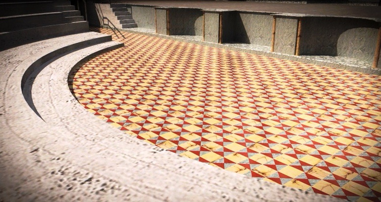
An orderly weaving of chessboard composed of square plates alternated to others divided into four triangles whose design was absolutely enhanced by the use of different marbles. In addition, the architectural decoration had to be completed in bronze statuary groups.

The stage wall, about 10 meters high, was richly decorated with columns, niches and statues, offering a sumptuous backdrop to the shows.

Stage, orchestra and cavea of the theatre by Francesco Corni (Reproduced with the kind permission of Fondazione Francesco Corni ©)
In the Middle Ages, other buildings were erected next to the theatre. These were only demolished in the first half of the 20th century thanks to a restoration campaign that allowed the theatre to be returned to the city.
A place of leisure and culture: the theatre was the center of social life in Augusta Praetoria. Theatrical performances, musical concerts, games and athletic competitions took place here. It was a meeting place for citizens, who gathered to have fun and socialize.
History and Roman Legacy
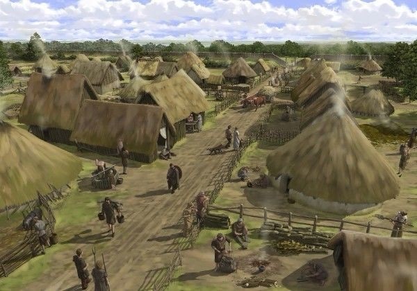
Aosta Valley in the 5th century BC was settled by Celtic peoples who moved from the north of Europe through the Alps in the direction of the Po Plain. During the reign of the Salassians, who dominated the valley for centuries, the inhabitants were scattered and there were no urban settlements.
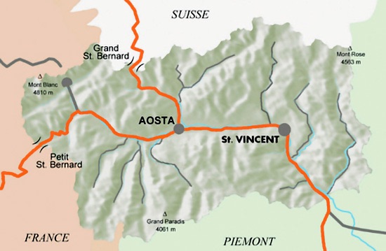
The location of the valley was strategic and guaranteed a lot of tax revenues for crossing the alpine passes: the Little Saint Bernard Pass and the Great Saint Bernard Pass.
In 143 BC a first military expedition of Roman consul Appius Claudius Pulcher, who attacked the Alpine tribe of Salassus, ended in defeat, but around 100 BC Romans founded the new settlement of Eporedia (today’s Ivrea) at a short distance from the Aosta Valley.
Rome was increasingly interested in controlling the entire alpine range and its strategic valleys. In 25 BC emperor Augustus got tired of skirmishes at the border and decided to definitively conquer the Salassian people. He sent a powerful military expedition led by consul Terenzio Varrone. The Roman Empire emerged victorious from the battle and the Aosta Valley was finally subjugated to Rome.
It is said that the Romans founded Aosta on the ruins of Cordelia, a legendary city founded in 1158 BC by Cordelio, founder of the Salasse. But recent archaeological discoveries show that the Salassi tribe was not the first to inhabit the territory. In 1969, during the works for, a legendary city founded in 1158 BC by Cordelio, founder of the Salassi. The conquest was a turning point in the history of the region: Romans completed the Gauls consular road and they established the new settlement Augusta Praetoria Salassorum (today’s Aosta, the capital of the Aosta Valley region) near the confluence of the Buthier stream with the Dora river and at the intersection of the two roads of the Grande and Piccolo San Bernardo.
The indigenous population was partly deported and partly merged with Romans. Historian Strabo wrote that “36,000 of them were sold at an auction” but it is probably an exaggeration, as an inscription paying homage to the Emperor from the Salassian people seems to prove.
The new Roman city had the primary purpose of controlling the Dora Baltea river valley and the nearby territories controlled by the Gauls.
The city was fortified with the residential neighborhoods and areas of public interest were located inside the walls, while the popular neighborhoods were outsidide.
The amphitheatre is, unusually for a Roman city, within the walls and, with the nearby theatre, it was part of an entertainment area not far from the Forum.
The city soon became one of the richest and most populous in Northern Italy, also due to the great strategic and military importance for its position of control over the surrounding territory.
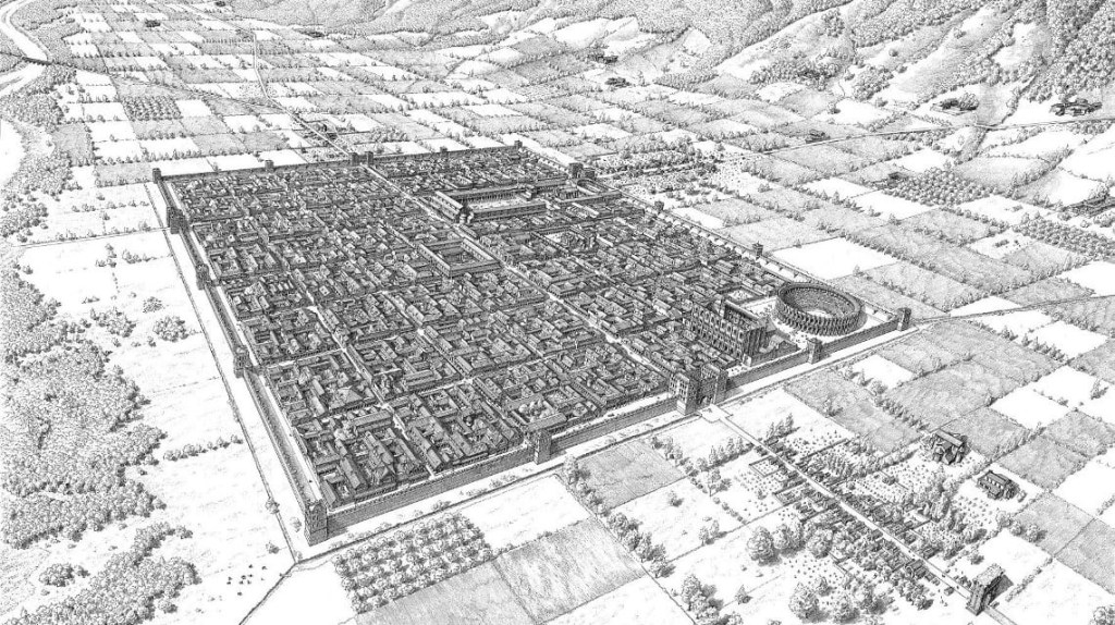
As for many other Italian cities, the orthogonal urban plan created by the Romans was maintained for a long time and is still recognizable today.
At the fall of the Roman Empire, the city of Aosta passed under the control of the Burgundians, following the struggles between the Emperors of Germany and the Italian princes.
Roman Itinerary
The Roman city shines through quite clearly: it is easy to recognize the Decumanus and Cardus Maximi, the ancient main streets of this strategic Augustan colony at the foot of the western Alps, the extreme bastion of the empire before it crossed over into Gallic and Swiss lands.
These main urban streets, originally up to 12 meters wide, have narrowed over the centuries, gradually occupied by houses, churches and palaces; in some places the road will not be wider than 4 meters.
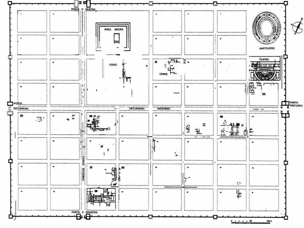
The map of Roman Aosta was a perfect chessboard, enclosed by imposing walls, with the various districts perfectly symmetrical and aligned.
The characteristic rectangle of the town of Augusta Prætoria (Aosta) derives from the natural limits marked to the north by the mountain slope, to the east by the course of the Buthier and to the south by that of the Dora Baltea.
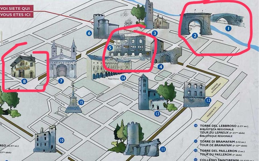
The Decumanus Maximus was the main axis of the city, along the traffic route. The Cardo Maximus crossed the decumanus at a right angle three-quarters of its length towards the west. The regular layout of the streets, which intersected perpendicularly, divided the internal space into rectangular insulae (blocks). The structures dedicated to entertainment were located in the north-eastern urban sector, the Theatre and the Amphitheatre, connected by a median portico that hosted spectators during breaks. This entertainment district was easily accessible even by those coming from outside the walls and entering the city from the Porta Prætoria
PORTA PRETORIA
The Porta Pretoria is the eastern entrance gate to the city, built in 25 BC, along with the rest of the walls.

It is made up of stone blocks fixed with crushed slate extracted directly from the seabed of the Dora Baltea river, which was particularly rich in Roman times. Over time, the drawgates that closed the eastern passages of the gate were lost, while the two series of arches are still preserved.
The central arch was intended for the passage of carts while the two on the sides were for pedestrians. That the Porta Pretoria was an excellent point of observation and control over the territory can be understood from the presence of walkways for sentries and two defensive towers, both remodeled over time.
On the eastern façade there are still traces of the marble slabs of the original cladding.
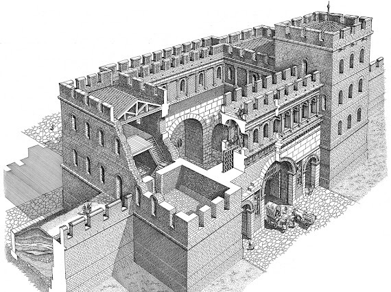
In the Middle Ages, a chapel dedicated to the Holy Trinity was built on top of the gate, but it was demolished in 1926.
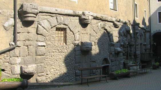
The other Roman gates of the city were the Porta Decumana (western entrance), the Porta Principalis Sinistra (northern entrance) and the Porta Principalis Dextera (southern entrance).
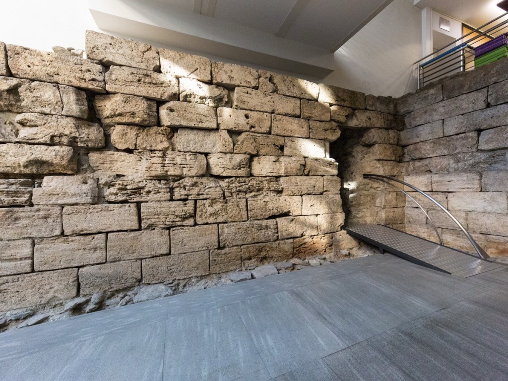
From the Porta Principalis Sinistra, the route that led to the Great St. Bernard Pass began. It originally had a similar plan to that of the Porta Prætoria, but in the 1st century AD it was significantly reduced. Currently it is possible to observe only the remains of the south-east corner of the eastern tower in the basement of the Regional Archaeological Museum.
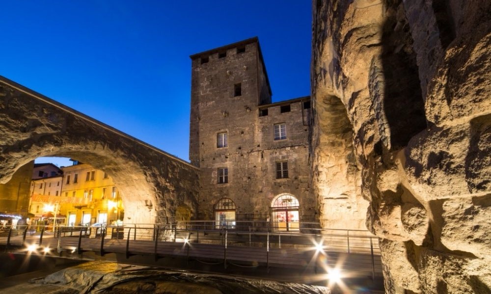
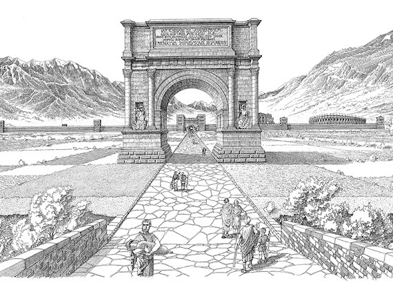
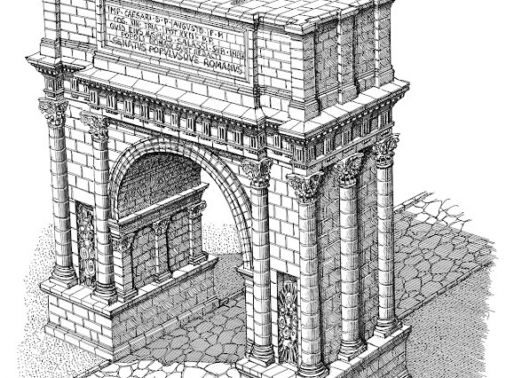
ARCH OF AUGUSTUS – The first thing you see as you enter the city is the Arch of Augustus, a sober and imposing structure typical of the late Republican period.
by Francesco Corni (Reproduced with the kind permission of Fondazione Francesco Corni ©)
Built in 25 B.C. to celebrate Rome’s victory over the local population, it is one of the starting points for any visit to the historic centre.
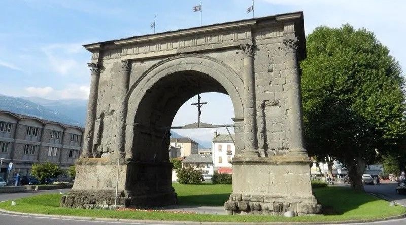
It stands 11.5 metres high and is made of soft local store that has deteriorated greatly over the years, so that the reliefs that once adorned it are now illegible; the arch was partly protected by a slate roof built in 1716 to shelter it from water penetration.
It was 8.29 metres wide like the road.
A Doric trabeation with triglyphs and metopes closes at the top what remains of the monument, which for centuries has been deprived of the attic on which the dedicatory inscription was placed in bronze letters.
The wooden crucifix displayed under the vault is a copy of the one that was placed there in 1449 as a votive offering against the flooding of the Buthier torrent, which flows a little to the east. The original crucifix is now kept in the Treasury Museum of the Cathedral of Aosta.
ROMAN BRIDGE – A short walk from the Arch, outside the city, is the Roman bridge, a humpback bridge which spans the old course of the Buthier stream, perfectly preserved and still in use today, which was part of the Roman Via delle Gallie.

In the Middle Ages, during an exceptional flood, the Buthier changed course, moving its bed further west. The bridge thus lost its function and, over the centuries, it was gradually buried, and only in modern times was it brought to light.
THE NECROPOLIS – An important necropolis from the Roman era was identified just outside the western Porta Decumana, along the public road that, through the Piccolo San Bernardo hill, led to Gaul.
The area includes two burial fields delimited by fences, within which tombs of various types have been found: the oldest are those in which the ashes of the deceased are preserved (pit, tiled box, well, small chamber, etc.), while those of inhumation, where the body of the deceased is buried, appear from the 2nd century and will later become the rule. At the end of the 4th century, in the transition from the pagan to the Christian religion, important works destroyed the existing tombs to erect three mausoleums linked to the cult of the dead (cellæ memoriæ), which will be joined not far away by an early Christian basilica.
AOSTA REGIONAL ARCHAEOLOGICAL MUSEUM – The Aosta Regional Archaeological Museum is housed in an elegant historical building in Piazza Ronca, 12, in the centre of Aosta.
It sits on the Roman structures of the Porta Principalis Sinistra and it displays a vast section with Roman artefacts related to funerary rites, public and private construction, and personal care.
The museum offers interactive equipment like the videos that illustrate the importance of the consular road that led to Gaul.
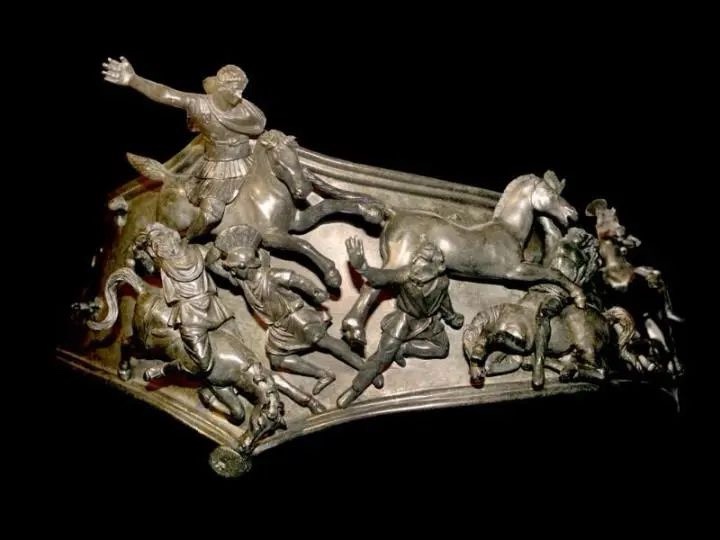
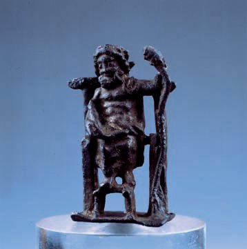
Notable is the baldric with battle scenes between Barbarians and Romans and the bust of Jupiter Graius in embossed silver, found on the Colle del Piccolo San Bernardo, associated with a rich ritual outfit.
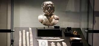
The bust of Jupiter Graius (2nd-3rd century AD)
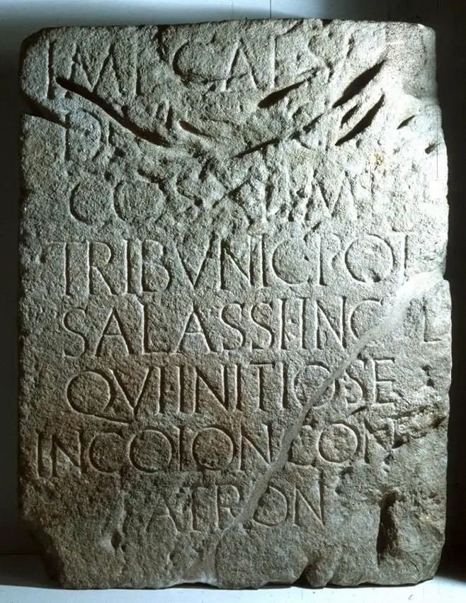
An important piece of Aosta Roman history is the inscription that the “Salassi Incolae” (inhabitants of the land of Salassi) dedicated to Emperor of Augustus in 23-21 BC after being conquered (See the picture in the previous section). It was on the sandstone podium of a statue of the Emperor that has been lost.
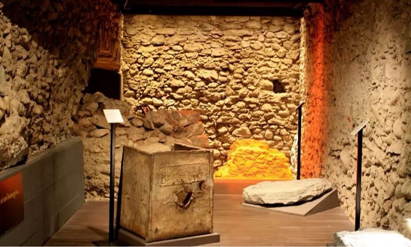
In the underground floor you can see the remains of the Roman walls, a section of the fortifications and the remains of the eastern tower.
THE AMPHITHEATRE – Built probably under Emperor Claudius in the 1st century AD, the Amphitheatre of Augusta Prætoria was a grandiose elliptical building measuring approximately 94 x 74 m, of which only eight arches remain visible in the north-west sector, incorporated into the structures of the current convent of San Giuseppe, and some portions of the load-bearing structures.
by Francesco Corni (Reproduced with the kind permission of Fondazione Francesco Corni ©)
Other remains are scattered across the lawn behind. There were 60 original arches and a two-storey structure with two tiers of steps. The public could reach the steps via 12 staircases placed at regular intervals, while an uncovered corridor allowed movement between the sectors of the stands.
The arena could probably be flooded for water games, while there no trace was found of underground spaces.
THE DOMUS – We conclude our itinerary with the Roman Domus discovered in 1971. Outside the ancient city walls, in Via Grand Tournalin, 2, in the Consolata area, it dates back to the 1st century BC. It is an urban-rustic villa, surrounded by cultivated land, and it was probably the summer residence of a Patrician.
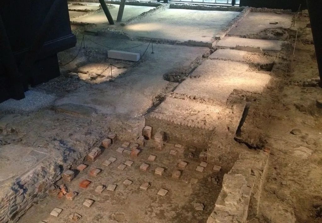
Some rooms are recognizable, with remains of mosaic flooring and traces of a heating system. The villa has a compact rectangular plan, in which the residential areas (pars urbana), reserved for the dominus and his guests, predominate over the service rooms, storage areas and, possibly, the processing of agricultural products (pars rustica and fructuaria).
The villa is organized around an atrium overlooking the Tablinum, the reception room, the Triclinium and the kitchen near the hot bath and the warehouses.

by Francesco Corni (Reproduced with the kind permission of Fondazione Francesco Corni ©)
The floors of many rooms of the villa were decorated with mosaics and there was also a thermal system.
The villa was abandoned and, between the 4th and 5th centuries AD, tombs arose in the surrounding area.
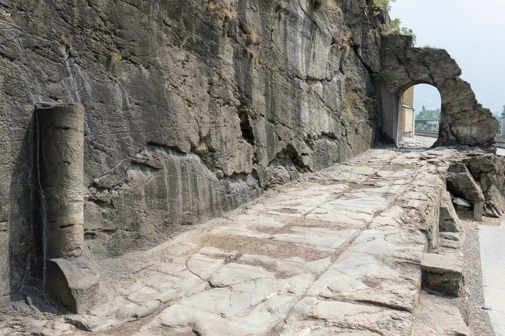
THE ROAD TO GAUL AT DONNAS – Ouside Aosta, one of the most spectacular sections of the Roman consular road to Gaul is the stretch carved for 221 meters into the living rock that culminates with a 4-meter-high arched passage. This astonishing work of the ancient Romans is located in Donnas, south-east of Aosta, a small town on the banks of the Dora Baltea near the vineyards that produce the Donnas red, the first DOC wine of Aosta Valley.
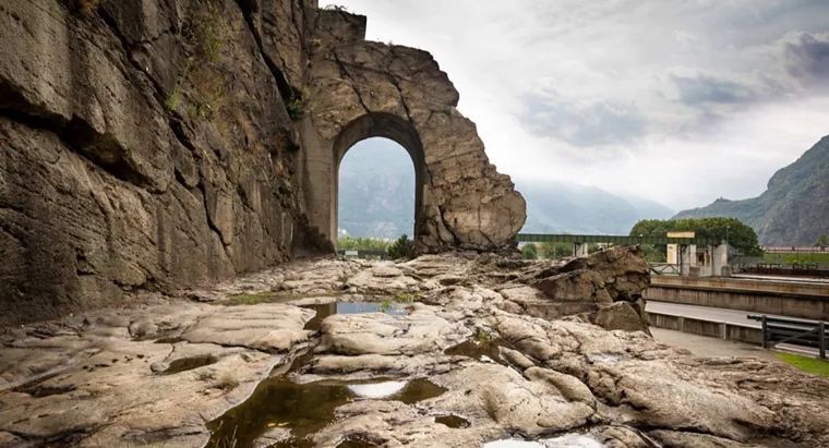
In a place where, in ancient times, the rocky promontory reached the waters of the Dora, Romans defied nature by carving the rock on which they built perfectly vertical walls and in whose womb they created the roadbed. The passage is 4 meters thick, 4 meters high and almost 3 meters.
A Roman milestone is still visible indicating the XXXVI milia passuum distance from Augusta Prætoria (about 53.24 km).
Fun Fact – The pass at Mount Jovis
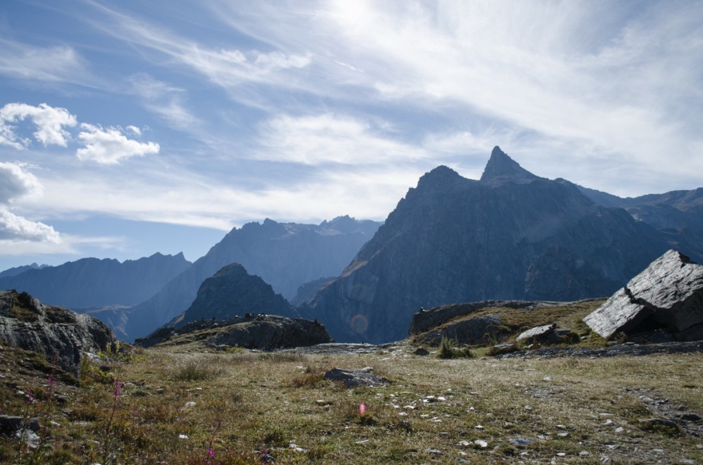
Follow us now to discover the Roman traces at the highest altitude ever found in Europe: 2.473 metres!
From the Porta Principalis Sinistra of Augusta Prætoria, departs the road to the Summus Pœninus, the Great St. Bernard Pass. The road, after skirting above a large glacial lake that still exists, headed towards the oppidum of Octodurus, later to become Forum Claudii Vallensium (Martigny). An itinerary already used in pre-Roman times that connected Rome to the north-western provinces of the Empire and that was for centuries one of the most important and strategic transit points in Europe despite the high altitude (2,473 m).
The pass is mentioned by the geographer Strabo in the 1st century AD. Improved by Augustus, it was made accessible to vehicles and, therefore, exploitable for military and commercial purposes only towards the middle of the 1st century AD, when the emperor Claudius, interested in the military conquest of Britannia, widened the road.
In prehistoric times, Mont Jovis, as the Romans later called it, was a point of communication between populations on this side and the other side of the Alps, as evidenced by the archaeological sites of Petit Chasseur in Sion and the megalithic area in Aosta.

In 47 AD, Emperor Claudius built a military road in place of the mule track to facilitate the connection between Mediolanum (Milan) and Octodurus (Martigny), capital of the Roman Civitas Vallensium.
Along the road to the Gran San Bernardo you can reach the archaeological site known as Plan de Jupiter (Jupiter basin) where the remains of a temple dedicated to Juppiter Poeninus and two functional buildings interpreted as belonging to a mansio were discovered. In the archaeological area is still visible the ancient Roman road dug into the rock. From here it is possible to reach, on the opposite side of the Alps, the city of Martigny, an ancient Celtic settlement known by the name of Octodurus and later the Roman capital of the Pennine Alps called Forum Claudii Vallensium.
The walls refer to mansio environments, buildings that sheltered travellers and animals, consisting of a central courtyard around which there were long, narrow rooms. These walls surround a “sacred cliff” where numerous coins were found, presumably left as votive offerings.
The only foundation cuts in the rock are what remains of a small Roman-Gallic temple with a cella and a pronao in front, facing the road. Several bronze votive tablets were found near this place of worship, left to thank Juppiter Pœninus (resulting from the syncretization of Celtic deity Poenina/Poeninus with Jupiter) for the fortunate journey and to ask for a safe return.
a pre-Roman deity worshipped by the Salassi and other Alpine people and the god of the Romans.
Penninus was ‘head, summit’ for Gauls so Iuppiter Pœninus was a Juppiter of the mountain.
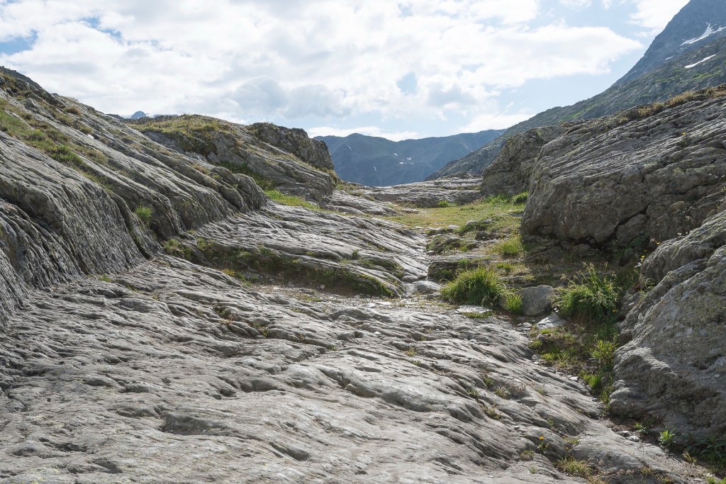
To reach the irregular rocky plateau of the Pass, the route is very steep and its layout has, as in many other cases, adapted to the Alpine environment. Only a few remains of the entire route remain visible.
A stretch of the ancient roadway is recognizable between the last bends before the pass, where for about 60 meters the road surface was obtained through a large incision in the rock.
When the danger of avalanches prevented travellers from reaching the basin or when they could not be accommodated there, two intermediate “refuges” located a short distance from the summit could be used, Plan de Barasson on the Swiss side and Fonteinte in Italy. These buildings have been identified by recent investigations, but the only trace currently visible is a pipeline dug into the rock that must have brought water to a building.
Useful Informations for Aosta
MAR – Museo Archeologico Regionale of Aosta
Piazza Roncas, 12. (+39) 0165.275902 mar@regione.vda.it
Tickets 5 € (reduction 3€) inclunding access to the Forum Cryptoporticus and to the early Christian church of San Lorenzo
- From October to March: open from 10 to 13 and from 14 to 18.00 Every day
- From April to September:
From 9 to 19 Every day
Our Tabernae- Where to Eat
TRATTORIA PRAETORIA – via di Sant’Anselmo, 9. +393472951337
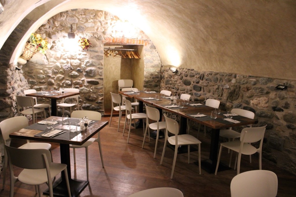
Regional dishes such as fondue and carbonada, as well as game dishes, in a room with wooden and stone elements.
ACKNOLEDGMENTS- A special thanks for this Aosta section goes to the Francesco Corni Foundation: Francesco Corni (1952-2020), a master of perspective and a pioneer of 3D drawing, narrated with ink and pen the places of architecture and history.
The Francesco Corni Foundation promotes educational drawing as a tool for dissemination and wants to carry on Francesco’s legacy by supporting research in this field.
Over the years Francesco has created thousands of original drawings, many of which are still unpublished. Francesco’s archive is a legacy that the Foundation wants to share with the public: it is possibile to browse in his digital archive of almost 2.000 drawings, a work in continuous evolution, that have been digitized to be easily consulted. All images are protected by copyright.

Leave a comment